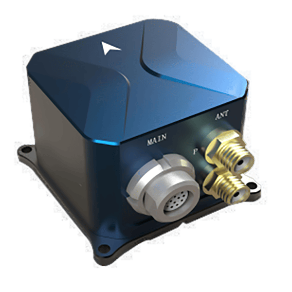
Inertial Measurement Units (IMU)

Premium Inertial Measurement Units and Tailored Solutions for Your Needs

At GYRONAVI, we are dedicated to delivering premium quality Inertial Measurement Units (IMUs) that offer unmatched precision and stability, engineered to support your most demanding applications. Our IMUs are designed with high accuracy and long-term reliability at their core, ensuring consistent and dependable performance in even the most dynamic and harsh environments.

Standard Products and Custom Solutions Offered

We understand the critical role that high-precision measurement plays in industries such as aerospace, marine, automotive, and defense. That’s why our expert team is constantly innovating and improving our products to meet the evolving needs of global customers. From cutting-edge technology to industry-leading customer service, we are committed to providing solutions that drive success and maximize efficiency.

Whether you’re working on complex navigation systems, motion sensing, or vibration control, GYRONAVI has the expertise and capability to offer the perfect IMU solution for your specific requirements. Our products have been widely trusted by clients around the world, helping them optimize their operations with exceptional performance and accuracy.

When you choose GYRONAVI, you’re not just buying a product—you’re investing in a partnership that will help elevate your projects to new heights. Our team is ready to assist you at every stage, from initial inquiry to after-sales support, ensuring a seamless and successful experience.

Military-grade green IMU with vibrational isolation mountings and multiple connectors.

Request More Details today to see how our products can support your projects.

Partial product display. For more products, please contact us

Product Overview

The GN3-IMU1-10 Fiber Optic Strapdown Inertial Navigation System is a compact and versatile inertial navigation system that integrates a fiber optic gyroscope (FOG) and a quartz flexure accelerometer.

This system is capable of detecting the angular motion and linear motion of unmanned aerial vehicles (UAVs), providing real-time output of position, velocity, heading, angular rate, and linear acceleration data. It can be integrated with a satellite receiver to perform integrated navigation computations, meeting the requirements for UAV attitude control, navigation, and positioning.

Product Features

  • Compact in size, lightweight, and easy to manufacture, with high reliability
  • Rich communication interfaces
  • Flexible output protocols, configurable through testing software
  • Provides vibration-damping accessories, suitable for harsh vibration environments
  • Equipped with a complete Built-In Test (BIT) strategy and has passed flight testing assessments
Black IMU unit with a sleek design, featuring an arrow logo and multiple connectors
A close-up of the high-precision IMU, ideal for navigation systems in various aerospace and automotive applications

Performance Specifications

ParameterSpecification
Alignment Time≤ 5 minutes
Position AccuracyPure Inertial: 2~5 nmile/30min (CEP); Satellite Integrated Navigation: Height 10m; Horizontal 5m
Velocity AccuracyIntegrated Navigation: Vertical speed ≤ 0.3m/s, Horizontal ≤ 0.2m/s
Heading Alignment Accuracy≤ 1.0° (1σ) (Self-alignment); ≤ 0.1° (1σ) (Dual Antenna, Baseline 2m)
Heading Hold Accuracy0.2°/h (Pure Inertial), 0.1° (Integrated Navigation)
Attitude Alignment Accuracy0.05° (1σ)
Attitude Hold Accuracy0.1° (Pure Inertial), 0.05° (Integrated Navigation)

Environmental Conditions

ParameterSpecification
Operating/Storage Temperature (°C)-40°C ~ +60°C / -45°C ~ +80°C
MTBF (Mean Time Between Failures)30,000 hours
Dynamic RangeAngular velocity: ±300°/s; Acceleration: -25g ~ 25g
Mechanical ShockHalf sine wave, 20g, 11ms
Mechanical Vibration1. No damping: GJB150.16A-2009 Figure C.3 Post-peak sawtooth wave; 2. With damping: GJB1032 Random vibration spectrum

Physical Characteristics

ParameterSpecification
Dimensions135mm x 135mm x 84mm
Mounting DimensionsNo damping: M6 screws, 121mm x 121mm; With damping: M4 screws, 121mm x 121mm
Weight≤ 2.1kg
Waterproof RatingIP67

External Interfaces

ParameterSpecification
Power Supply18V ~ 36V DC
Power Consumption≤ 11W
Input/Output InterfacesRS-422 x3 (multiplexed), RS-232 x2 (multiplexed), 1x LVTTL interface, 2x CAN, 1x Ethernet port, 2x Pulse interfaces, 8G Data storage
Data Output Frequency≤ 1000Hz

Product Overview

The GN3-IMU1-20 Fiber Optic Strapdown Inertial Navigation System is a miniaturized and versatile inertial navigation system that integrates high-precision fiber optic gyroscopes (FOG) and quartz flexure accelerometers. The product features a compact design.

This system is capable of detecting both angular and linear motion of unmanned aerial vehicle (UAV) platforms, providing real-time output of position, velocity, heading, angular rate, and linear acceleration data. It can be integrated with a satellite receiver to perform integrated navigation calculations, meeting the requirements for UAV attitude control, navigation, and positioning.

Product Features

  • Compact, lightweight, high-precision design, with excellent manufacturability and high reliability
  • Rich communication interfaces
  • Flexible output protocols, configurable via testing software
  • Provides vibration-damping accessories, suitable for harsh vibration environments
  • Equipped with a comprehensive Built-In Test (BIT) strategy, successfully validated through flight testing
Compact IMU unit with an arrow logo, offering multiple connection ports.
A sleek IMU unit designed for precision and efficiency, featuring a compact design and a prominent arrow logo for brand identity

Performance Specifications

ParameterSpecification
Alignment Time≤ 5 minutes
Position AccuracyPure Inertial: 2 nmile/h (CEP); Satellite Integrated Navigation: Height 10m; Horizontal 5m
Velocity AccuracyIntegrated Navigation: Vertical speed ≤ 0.2m/s, Horizontal ≤ 0.1m/s
Heading Alignment Accuracy≤ 0.1° (1σ) (Self-alignment)
Heading Hold Accuracy0.02°/h (Pure Inertial), 0.03° (Integrated Navigation)
Attitude Alignment Accuracy0.02° (1σ)
Attitude Hold Accuracy0.03° (Pure Inertial), 0.02° (Integrated Navigation)

Environmental Conditions

ParameterSpecification
Operating/Storage Temperature (°C)-40°C ~ +60°C / -45°C ~ +80°C
MTBF (Mean Time Between Failures)30,000 hours
Dynamic RangeAngular velocity: ±300°/s; Acceleration: -25g ~ 25g
Mechanical ShockHalf sine wave, 20g, 11ms
Mechanical Vibration1. No damping: GJB150.16A-2009 Figure C.3 Post-peak sawtooth wave; 2. With damping: GJB1032 Random vibration spectrum

Physical Characteristics

ParameterSpecification
Dimensions175mm x 140mm x 110mm
Weight≤ 3.6kg
Waterproof RatingIP67

External Interfaces

ParameterSpecification
Power Supply18V ~ 36V DC
Power Consumption≤ 15W
Input/Output InterfacesRS-422 x2 (multiplexed), RS-232 x3 (multiplexed), 2x CAN, 1x dual CAN, 2x Pulse interfaces, 8G Data storage
Data Output Frequency≤ 1000Hz

Product Overview

The GN3-IMU1-30 Fiber Optic Strapdown Inertial Navigation System is a miniaturized, general-purpose inertial navigation system that integrates high-precision fiber optic gyroscopes (FOG) and quartz flexure accelerometers. This system is capable of detecting both angular and linear motion of unmanned aerial vehicle (UAV) platforms, providing real-time outputs for position, velocity, heading, angular rate, and linear acceleration data. It can be combined with a satellite receiver to perform integrated navigation computations, meeting the requirements for attitude control, navigation, and positioning for various UAV applications.

Product Features

  • Compact, lightweight, high-precision design, with excellent manufacturability and high reliability
  • Dual board card operation mode
  • Rich communication interfaces
  • Flexible output protocols, configurable via testing software
  • Provides vibration-damping accessories, suitable for harsh vibration environments
  • Equipped with a comprehensive Built-In Test (BIT) strategy, successfully validated through flight testing
High-performance IMU unit in black with multiple connectors for diverse applications.
High-performance IMU designed for complex navigation systems, featuring several connectors for integration flexibility.

Performance Specifications

ParameterSpecification
Alignment Time≤ 5 minutes
Position AccuracyPure Inertial: 1 nmile/h (CEP); Satellite Integrated Navigation: Height 10m; Horizontal 5m
Velocity AccuracyIntegrated Navigation: Vertical speed ≤ 0.2m/s, Horizontal ≤ 0.1m/s
Heading Alignment Accuracy≤ 0.06° (1σ) (Self-alignment)
Heading Hold Accuracy0.01°/h (Pure Inertial), 0.02° (Integrated Navigation)
Attitude Alignment Accuracy0.01° (1σ)
Attitude Hold Accuracy0.02° (Pure Inertial), 0.01° (Integrated Navigation)

Environmental Conditions

ParameterSpecification
Operating/Storage Temperature (°C)-40°C ~ +60°C / -45°C ~ +80°C
MTBF (Mean Time Between Failures)30,000 hours
Dynamic RangeAngular velocity: ±300°/s; Acceleration: -25g ~ 25g
Mechanical ShockHalf sine wave, 20g, 11ms
Mechanical Vibration1. No damping: GJB150.16A-2009 Figure C.3 Post-peak sawtooth wave; 2. With damping: GJB1032 Random vibration spectrum

Physical Characteristics

ParameterSpecification
Dimensions160mm x 160mm x 140mm
Weight≤ 4.0kg
Waterproof RatingIP67

External Interfaces

ParameterSpecification
Power Supply18V ~ 36V DC
Power Consumption≤ 18W
Input/Output InterfacesRS-422 x4 (multiplexed), RS-232 x3 (multiplexed), 2x CAN (FD), 1x Ethernet, 2x Pulse interfaces, 8G Data storage, 1x USB
Data Output Frequency≤ 1000Hz

Product Overview

The GN3-IMU1-40 Fiber Optic Sway-Inertial Navigation System is designed for large unmanned aerial vehicles (UAVs). The system is highly sensitive to both angular and linear motion of the UAV. It outputs real-time data including the vehicle’s position, velocity, heading, angular rate, and linear acceleration. By integrating with satellite receivers, it performs combined navigation calculations and meets the attitude control, navigation, and positioning needs of various UAVs.

Product Features

  • High Accuracy and Reliability: The system ensures precise performance and high reliability.
  • Convenient Installation with Built-In Vibration Damping: Features easy installation and a built-in vibration damping mode to withstand harsh vibration environments.
  • Diverse Communication Interfaces: Equipped with a variety of communication interfaces for flexible connectivity.
  • Flexible Output Protocols: Output protocols are customizable and can be configured via testing software.
  • Comprehensive BIT Strategy with Successful Flight Test: The system is equipped with a complete Built-In Test (BIT) strategy and has successfully passed flight testing.
Black IMU unit with a top arrow logo and multiple ports for different applications
Designed for high-accuracy systems, this IMU unit boasts versatility with its multi-port setup, ideal for both commercial and industrial use

Performance Specifications

ParameterSpecification
Alignment Time≤ 5 minutes
Position AccuracyPure Inertial: 1 nmile/h (CEP); Satellite Integrated Navigation: Height 10m; Horizontal 5m
Velocity AccuracyIntegrated Navigation: Vertical speed ≤ 0.2m/s, Horizontal ≤ 0.1m/s
Heading Alignment Accuracy≤ 0.06° (1σ) (Self-alignment)
Heading Hold Accuracy0.01°/h (Pure Inertial), 0.02° (Integrated Navigation)
Attitude Alignment Accuracy0.01° (1σ)
Attitude Hold Accuracy0.02° (Pure Inertial), 0.01° (Integrated Navigation)

Environmental Conditions

ParameterSpecification
Operating/Storage Temperature (°C)-40°C ~ +60°C / -45°C ~ +80°C
MTBF (Mean Time Between Failures)30,000 hours
Dynamic RangeAngular velocity: ±300°/s; Acceleration: -25g ~ 25g
Mechanical VibrationWith damping: GJB1032 Random vibration spectrum

Physical Characteristics

ParameterSpecification
Dimensions215mm x 166mm x 140mm
Weight≤ 6.0kg
Waterproof RatingIP67

External Interfaces

ParameterSpecification
Power Supply18V ~ 36V DC
Power Consumption≤ 18W
Input/Output InterfacesRS-422 x4 (multiplexed), RS-232 x1 (multiplexed), 1x CAN, 1x Ethernet, 2x Pulse interfaces, 8G Data storage
Data Output Frequency≤ 1000Hz

Product Overview

The GN3-IMU1-50 is an integrated control unit that combines a medium-to-high precision fiber-optic integrated navigation system as the core. It integrates various functions, including flight control, integrated navigation, atmospheric sensing, large-capacity file storage, and power-off USB reading. After the integrated control unit is powered on, it performs a self-check, completes the self-check and parameter binding, and then begins the alignment process. Once the alignment is complete, the integrated navigation module enters the integrated navigation state upon receiving the “switch to navigation” command.

Product Features

  • Integration of flight control, integrated navigation, atmospheric sensing, large-capacity file storage, and power-off USB reading functions
  • Short preparation time
  • High precision
  • Small and compact
  • Low power consumption, enabling long-duration operation
  • Rich external interfaces
Durable black IMU with a prominent arrow logo, featuring multiple ports for efficient connection.
Engineered for aerospace applications, this durable IMU provides reliable and accurate navigation capabilities

Performance Specifications

ParameterSpecification
Alignment Time270 seconds
Position Accuracy≤ 1 nmile (1σ, 1h)
Velocity Accuracy≤ 4 m/s (1σ, 1h)
Heading Hold Accuracy< 0.05° (1σ)
Attitude Hold Accuracy≤ 0.03° (1σ)
Atmospheric Measurement Accuracy (Pressure)[0,6000]m ≤ 30m; (6000,13000]m ≤ 100m
Atmospheric Measurement Accuracy (Mach Number)[0,6000]m, Ma[0.25,0.9] ≤ 0.015, [6000,13000]m, Ma[0.5,0.9] ≤ 0.015

Operating Environment

ParameterSpecification
Operating/Storage Temperature-50°C ~ 65°C / -55°C ~ 55°C (start at -40°C)
MTBF (Mean Time Between Failures)2681 hours; Repeatability not less than 50 times, each mission duration ≥ 6 hours; Reliability no less than 0.9997 (confidence level 0.8)
Dynamic RangeAngular rate: ±300°/s; Acceleration: ±20g
Mechanical CharacteristicsVibration: 7.7g, 3 axes, 1 hour per axis; Shock: 26.7g, 11ms

Physical Characteristics

ParameterSpecification
Dimensions220mm x 230mm x 147mm
Mounting Dimensions218mm x 188mm
Weight≤ 6.9 kg

External Interfaces

ParameterSpecification
Power SupplyDC 18V ~ 36V
Power Consumption≤ 30W
Input/Output Interfaces10 intelligent RS422 serial ports, baud rate configurable (default 614.4Kbps); 1 differential RS422 acquisition port; 2 CAN bus communication ports, baud rate configurable up to 1Mbps, CAN 2.0B protocol standard, CAN interface transceiver driver ISO1050
Data Output Frequency200Hz

Product Overview

GN3-IMU1-60 is a single-axis rotating inertial navigation system that combines high-precision fiber optic gyroscopes and quartz flexible accelerometers. It utilizes rotational modulation to suppress the divergence of navigation errors. The system comes with a default configuration of a satellite receiver set, supporting differential positioning, dual-antenna direction finding, and multi-channel integrated navigation capabilities. The system uses an information fusion algorithm to assess the validity of satellite navigation data, enabling timely detection of spoofing signals and ensuring safe aircraft departure from the spoofing area. It also supports interfaces for astronomical navigation and visual navigation, meeting the requirements for UAV attitude control, navigation, and positioning.

Product Features

  • High reliability, lightweight, and long endurance with high-precision navigation.
  • Rich and flexible integrated navigation modes, with smooth switching between modes and fault-tolerant navigation capabilities.
  • Supports various startup conditions, enabling quick response to in-flight power failure and reboot.
  • Excellent adaptability to vibration, shock, and thermal composite environments.
  • Comprehensive Built-In Test (BIT) design.
IMU with enhanced durability, multiple ports, and a sleek black body for harsh environments.
Built to endure harsh environments, this IMU is equipped with robust connectors and an efficient design for rugged conditions

Performance Specifications

ParameterSpecification
Alignment TimeGround alignment: ≤ 5 min, emergency alignment, ground alignment 30s + airborne alignment 10 min
Position Accuracy (CEP)Inertial: 1.5 nmile/6h; Inertial/Satellite Combined: After 15 min, 1.0 nmile/6h, ≤ 10m
Speed Accuracy (RMS)Inertial: ≤ 1 m/s (6h); Inertial/Satellite Combined: ≤ 0.2 m/s
Attitude Angle Accuracy (RMS)Inertial: ≤ 0.02° (6h); Inertial/Satellite Combined: ≤ 0.02°
Heading Angle Accuracy (RMS)Inertial: ≤ 0.05° (6h); Inertial/Satellite Combined: ≤ 0.05°

Application Environment

ParameterSpecification
Operating/Storage Temperature (°C)-55°C ~ +70°C
Dynamic RangeAngular Velocity: ±300°/s, Acceleration: -30g ~ +30g
Mechanical CharacteristicsShock Environment: Half-sine wave 20g, 11ms; Vibration Environment: Typical UAV vibration environment

Physical Characteristics

ParameterSpecification
Dimensions (mm)175mm x 216mm x 175mm
Mounting MethodDirect mounting (waist mount) or optional bracket mount (bottom mounting)
Mounting Dimensions (mm)Bracket mount dimensions: 224mm x 220mm (mounting hole: Ø8.5mm)
WeightMain unit ≤ 7.0kg; Bracket (optional) ≤ 1.5kg or customized

External Interfaces

ParameterSpecification
Power Supply18V~36V DC, Power consumption ≤ 32W
Input/Output Interfaces7 x RS-422, 1 x RS-232, 2 x CAN (FD), 1 x 1M 1553B, 1 x 4M 1553B
Data Output Frequency200Hz (typical)

Product Overview

Product Overview

The GN3-IMU1-120 fiber optic gyro strapdown navigation system is built on a fiber optic inertial navigation platform. This platform adopts a universal design philosophy, making it easy to adapt to customer requirements. It offers advantages such as short delivery times, high maturity, and excellent reliability.

Product Features

  • Utilizes 120-series fiber optic gyroscopes and quartz flexible accelerometers.
  • The 120-series fiber optic gyroscope zero bias stability is better than 0.005°/h (1σ).
  • The accelerometer zero bias stability is better than 50μg (1σ).
  • Supports both static and dynamic base alignment, with options for self-alignment, in-motion alignment, or handover alignment based on user requirements.
  • Can integrate with various information sources such as satellites, laser speedometers, odometers, and altimeters for combined navigation, with strong interface expandability.
Military-grade IMU unit with an arrow logo and multiple ports for advanced navigation systems.
Built for military applications, this IMU offers robust build quality and advanced connectivity for high-performance navigation systems

System Performance

ParameterVehicle NavigationVessel NavigationDrone NavigationShip Local Reference
Position (CEP)≤ 0.1% D (Odometer Assisted) ≤ 0.1m (Differential GPS Assisted)1nm/8h (Odometer Assisted) ≤ 0.1m, Differential GPS Assisted≤ 0.8nmile/h≤ 1m (Relative)
Speed (1σ)≤ 0.2m/s≤ 0.6m/s≤ 0.8m/s≤ 0.2m/s (Relative)
Heading (1σ)≤ 0.5mil≤ 0.5mil≤ 0.5mil≤ 0.2mil (Relative)
Attitude (1σ)≤ 0.02°≤ 0.02°≤ 0.02°≤ 0.01° (Relative)
Alignment Time5min15-20min5min5min

System Characteristics

ParameterSpecification
Power Consumption≤ 20W
Dimensions335mm (L) x 200mm (W) x 146mm (H)
Weight12kg
Input Voltage18V ~ 32V
Operating Temperature-40°C ~ +65°C
ShockHalf sine wave 30g, 11ms
VibrationGJB150.16A-2009.C.3
Interface InformationRS-422 x 2, RS-232 x 1, Ethernet, CAN bus, Odometer x 1, Altimeter, Speedometer

Device Performance

GyroscopeSpecificationAccelerometerSpecification
 Zero Bias Stability≤ 0.005°/h, 1σZero Bias Repeatability≤ 50µg, 1σ
Zero Bias Repeatability≤ 0.005°/h, 1σZero Bias Stability≤ 100µg, 1σ
Scale Factor ≤ 30ppm, 1σScale Factor Repeatability≤ 50ppm, 1σ
Random Walk≤0.001°/, 1σScale Factor Stability≤ 50ppm, 1σ


Product Overview

The GN3-IMU1-70A is a dual-axis rotating inertial navigation system. It utilizes high-precision fiber optic gyroscopes and quartz-flexible accelerometers, suppressing navigation error divergence through rotational modulation. The system can output real-time data on position, velocity, attitude, angular rate, and linear acceleration. It reserves satellite receiver and barometric sensor module interfaces, allowing easy integration for user selection. With interfaces for celestial and visual navigation, the system supports various switchable navigation modes, including inertial, satellite, and atmospheric combinations, to meet the attitude control, navigation, and positioning needs of UAVs.

Product Features

  • Long endurance with high-precision inertial navigation capability.
  • Supports multiple switchable navigation modes including inertial, satellite, and atmospheric combinations.
  • Excellent adaptability to vibration, shock, and thermal environments.
  • Equipped with an in-situ self-calibration and maintenance function.
  • Comprehensive Built-In Test (BIT) design for system health monitoring.
IMU with integrated mounting brackets, providing stability and easy installation in various systems.
The IMU features integrated mounting brackets for easy installation and enhanced system stability.

Performance Indicators

ParameterSpecification
Alignment TimeGround normal alignment: ≤ 13min, emergency alignment, ground alignment 30s + air alignment 15min
Position Accuracy (CEP)Pure Inertial: 1 nmile / 12h
Speed Accuracy (RMS)Pure Inertial: 1 m/s / 12h
Heading Alignment Accuracy (RMS)≤ 0.5°
Heading Hold Accuracy (RMS)≤ 0.03° (12h)
Attitude Hold Accuracy (RMS)≤ 0.015° (12h)

Application Environment

ParameterSpecification
Operating/Storage Temperature-55°C ~ +70°C
Dynamic RangeAngular velocity: ±300°/s; Acceleration: -30g ~ +30g
Mechanical CharacteristicsShock environment: Half sine wave 20g, 11ms
Mechanical CharacteristicsVibration environment: Typical drone vibration environment

Physical Characteristics

ParameterSpecification 1Specification 2
Dimensions180mm x 228mm x 247mm180mm x 268mm x 250mm
Mounting TypeBracket MountingAviation Bracket Mounting
Mounting DimensionsBracket Mounting Dimensions: 200mm x 224mm; Flange Mounting Dimensions: 176mm x 198mmBracket Mounting Dimensions: 280mm x 190mm
WeightMain Unit: ≤ 12.5kg; Bracket: ≤ 1.5kgMain Unit: ≤ 12.5kg; Bracket: ≤ 1.5kg

External Interface 

ItemSpecification
Power Supply18V~36V DC, Power Consumption ≤ 36W, Power Interrupt ≤ 5ms
Input/Output Interfaces7x RS-422, 1x RS-232, 2x CAN (FD), 1x 1M 1553B, 1x 4M 1553B
Data Output Frequency200Hz (Typical)

Product Overview

The HGL-IMU90 Series Inertial Navigation System is a high-precision laser strapdown inertial navigation system that is small in size, lightweight, highly accurate, and reliable. It is designed to meet the needs of long-duration autonomous navigation in complex environments. The system is suitable for various short-duration navigation, integrated navigation, guidance, and control applications. The heading alignment accuracy is better than ≤0.3 mil (1σ), and the pure inertial navigation accuracy is better than 0.5 nmile/h (CEP). The system can integrate satellite, radio, barometric altimeter, Doppler, and odometer data to achieve high-precision integrated navigation.

Product Features

  • Lightweight and High Precision: The 15 kg class lightweight high-precision laser strapdown product, reduces weight by 40% compared to traditional systems.
  • High-Precision Gyroscope and Accelerometer: Utilizes a high-precision three-axis laser gyroscope and quartz flexible accelerometer. The laser gyroscope zero-bias stability is better than 0.001°/h (1σ).
  • Accelerometer Stability: The accelerometer zero-bias stability is better than 30 μg (1σ)
  • Flexible Alignment Modes: Supports static and dynamic base alignment, with options for self-alignment, in-motion alignment, or hand-over alignment based on user requirements.
  • Comprehensive Integration: Capable of integrating with various information sources such as satellite, odometer, altimeter, and star sensor, providing strong interface expandability for integrated navigation.
Green IMU with an arrow logo, multiple connectors for extended functionality in high-precision systems.
High-performance IMU with enhanced connectivity, featuring a compact green casing and multiple ports for a wide range of applications

System Performance

ApplicationPosition (CEP)Velocity (1σ)Heading (1σ)Attitude (1°)Alignment Time
Vehicle Navigation≤ 0.05% D (Odometer Assisted)≤ 0.1 m (Differential Satellite Assisted)≤ 0.2 m/s≤ 0.3 mil≤ 0.02°5 min
Marine Navigation≤ 1 nm/24h (Odometer Assisted)≤ 0.1 m (Differential Satellite Assisted)≤ 0.6 m/s≤ 0.3 mil≤ 0.02°15-20 min
UAV Navigation≤ 0.5 nmile/h≤ 0.6 m/s≤ 0.3 mil≤ 0.02°5 min
Ship Local Reference≤ 1 m (Relative)≤ 0.2 m/s (Relative)≤ 0.1 mil (Relative)≤ 0.01° (Relative)5 min

System Characteristics

ParameterSpecification
Power Consumption≤ 40W
Dimensions300mm (L) x 250mm (W) x 220mm (H)
Weight15kg
Input Voltage18V ~ 32V
Operating Temperature-40°C ~ +65°C
Mechanical ShockHalf sine wave, 30g, 11ms
Mechanical VibrationGJB150.16A-2009.C.3
Interface InformationRS-422 x2, RS-232 x1, Ethernet interface, CAN bus interface, Odometer interface x1, Altimeter interface, Speedometer interface

Device Performance

ParameterGyroscopeAccelerometer
Bias Stability≤ 0.001°/h, 1σ≤ 30μg, 1σ
Bias Repeatability≤ 0.001°/h, 1σ≤ 30μg, 1σ
Scale Factor≤ 5ppm, 1σ≤ 50ppm, 1σ
Random Walk≤ 0.0005°/√h,1σ

Product Overview

GN3-IMU2-10 Laser Strapdown Inertial Navigation System is a compact and high-precision system designed to meet the demands of autonomous navigation in complex environments. It is lightweight, small in size, highly accurate, and reliable. The system is suitable for various navigation, integrated navigation, guidance, and control applications. It can integrate satellite, radio, barometric altimeter, Doppler, and other information sources to achieve high-precision integrated navigation.

Product Features

  • 3.6kg class laser strapdown inertial navigation system
  • Utilizes  high-precision three-axis laser gyroscopes and quartz flexible accelerometers
  • Capable of ground shake base alignment and airborne alignment
  • Offers flexible alignment options including self-alignment, in-motion alignment, or transfer alignment based on user requirements
  • Can integrate with satellite, Doppler, altimeter, radio, star sensors, and other information sources for combined navigation, with strong interface expandability
Military-grade green IMU with vibrational isolation mountings and multiple connectors.
Designed for harsh environments, this IMU features a robust green housing with vibrational isolation mountings, ideal for military and aerospace applications.

Performance Specifications

ParameterClass IClass II
Position Accuracy0.5 nmile/h (CEP)0.8 nmile/h (CEP)
Velocity Accuracy0.5 m/s (RMS)0.8 m/s (RMS)
Heading Alignment Accuracy ≤ 0.02 ° (1σ)≤ 0.04 ° (1σ)
Heading Hold Accuracy (Pure Inertial)≤ 0.005°/h (1σ)≤ 0.008°/h (1σ)
Heading Hold Accuracy (Integrated Navigation)≤ 0.005° (1σ)≤ 0.005°(1σ)
Attitude Alignment Accuracy (Pure Inertial)0.003° (1σ)0.005°(1σ)
Attitude Hold Accuracy (Pure Inertial)≤ 0.003°/h (1σ)≤ 0.005°/h(1σ)
Attitude Hold Accuracy (Integrated Navigation)≤ 0.003° (1σ)≤ 0.005° (1σ)

Environmental Conditions

ParameterSpecification
Operating/Storage Temperature (℃)-40°C ~ +60°C (Operational after startup at -50°C) / -55°C ~ +70°C
MTBF (Mean Time Between Failures)2500 hours
Dynamic RangeAngular velocity: ±400°/s; Acceleration: ±30g
Mechanical CharacteristicsMechanical shock: Half sine wave, 20g, 11ms; Vibration: GJB150.16A-2009.C.3; GJB1032 Random vibration spectrum

Physical Characteristics

ParameterSpecification
Dimensions185mm x 139.5mm x 110mm
Mounting Dimensions237mm x 176mm x 122mm
WeightMain unit: 3.9kg; Bracket: 0.4kg
Waterproof RatingIP67

External Interfaces

ParameterSpecification
Power Supply18V ~ 36V DC
Power Consumption≤ 27W
Input/Output Interfaces3x RS-422×3,1x RS-232, 1x LVTTL sync input, 1x differential sync input, 1x differential sync output
Data Output Frequency200Hz

Product Overview

The GN-V-MC01 LiDAR point cloud map matching and environmental perception device can achieve high-precision map matching positioning, online precise mapping, typical target recognition and tracking, and relative distance measurement, based on inertial navigation information, satellite navigation information, and LiDAR/camera information. This device features high precision, strong versatility, and high reliability. It is capable of meeting the real-time environmental perception needs of autonomous vehicles, autonomous follow-up tasks, and other similar applications.

Product Features

  • High precision: The relative positioning accuracy is better than 0.1m, and the absolute positioning accuracy in high-precision map matching is better than 1m.
  • Strong versatility: The product adopts a standard 6U chassis design, which facilitates user product configuration.
  • Highly expandable interfaces: It supports plug-and-play integration with various information sources such as satellites, LiDAR, visible light cameras, etc.
  • Strong environmental adaptability: It meets the vibration, shock, and temperature requirements of various unmanned vehicles, drones, and unmanned ships.
Military-grade green IMU with multiple connectivity ports and secure handling features.
Built for military applications, this IMU unit features a robust green housing with multiple ports for high-performance navigation systems

System Performance

ParameterGeneral Map-Assisted NavigationHigh-Precision Map-Assisted NavigationTarget Recognition AccuracyDesignated Target Relative Measurement Distance
Position (CEP)10m1m95%0.1m, within 50m
Preparation Time 5min5min5min5min

System Characteristics

ParameterSpecification
Power Consumption≤ 200W
Dimensions6U chassis
Weight15kg
Input Voltage18V ~ 32V, DC / 220V, AC (optional)
Operating Temperature-40°C ~ +65°C
ShockHalf-sine wave 30g, 11ms
VibrationGJB150.16A-2009.C.3
Interface InformationRS-422: RS-232; Ethernet interface; CAN bus interface; Odometer interface; Altimeter interface; Speedometer interface

Product Overview

The GN-V-MC02 is an aerial inertial-visual navigation product, primarily consisting of inertial navigation, visible light cameras, infrared cameras, and AI data processing circuits. It is based on optical imaging and inertial measurement principles to provide unmanned aerial vehicles (UAVs) with a combination of inertial/visual attitude, velocity, position information, as well as angular velocity and acceleration data.

This product integrates the artificial intelligence technology that has brought groundbreaking changes to the image and video recognition fields into the UAV navigation domain. Through the fusion of inertial and machine vision data, it enables high-precision real-time measurement of the aircraft’s motion parameters. It provides a complete solution for autonomous guidance and navigation of UAVs throughout their flight profiles—takeoff, cruise, and landing—without relying on satellites.

Product Features

  • Provides autonomous navigation information for UAVs during the entire mission profile, including takeoff, cruise, and landing.
  • AI-based all-weather autonomous runway recognition at airports, enabling emergency landings at unfamiliar airports.
  • Flexible installation for forward and downward views, with the ability to integrate additional payloads such as pod-mounted cameras.
  • Applicable in diverse environments such as gobi deserts, mountainous regions, and urban areas.
  • Independent of satellites and predefined maps, ensuring operational flexibility.
  • Integrated design of imaging and navigation systems.
  • Strong adaptability to aerial environments.
  • High-precision inertial/visual information fusion for enhanced accuracy.
  • Fusion of visible light and infrared imagery, with SDI standard video output.
  • Real-time display of target detection results.
Dual-sensor infrared IMU with a specialized mounting system for tracking applications.
This advanced dual-sensor IMU features an infrared design for precise target tracking, with a secure mounting system for stability.

Performance Indicators

StateEffective RangeNavigation Accuracy
TakeoffBefore liftoff1.0m (1σ, lateral accuracy)
Cruising1km~8km (relative altitude)20m + 1%H (1σ, horizontal positioning accuracy, H is the relative altitude of the aircraft above the ground)
LandingForward distance: 5km~stop (runway width no less than 45m)1.0m + 1%D (1σ, lateral accuracy, D is the horizontal distance between the aircraft and the runway endpoint)

Application Environment 

ParameterSpecification
Operating Temperature-40°C ~ +60°C
Storage Temperature-45°C ~ +65°C
System PreparationStatic base alignment time: 5 minutes
Field of View (Visible Light)57.80° x 34.50°
Field of View (Infrared)35.83° x 27.26°

Physical Characteristics

ParameterSpecification
Dimension179mm x 140mm x 126mm
Weight≤ 2.0kg
Forward Installation Dimensions10-M3x8mm Thread Hole
Downward Installation Dimensions4-M4x8mm Thread Hole

External Interfaces

ParameterSpecification
Power Supply28V, adjustable range 24V~36V
Power Consumption≤ 40W
User ConnectorF104Z19K092-140, provides power and communication
Debug ConnectorF104Z19K086-240, for software upgrade
Standard SMA Connectors1920×1080 @ 30Hz SDI Video Output
Communication Interface (RS422 Serial Port)Multiple RS422 serial ports
Inertial Information Input200Hz
Flight Control Command Input5Hz
Inertial/Visual Navigation Information Output100Hz

Product Overview

The GN3-IMU3-10 is a compact, high-precision MEMS-based product, consisting of three high-precision MEMS gyroscopes, three high-precision MEMS accelerometers, a microprocessor, and a satellite receiver. It is suitable for various applications, including combined navigation, short-term pure inertial navigation, guidance, and control.

Product Features

  • Compact size, lightweight, and low power consumption, making it highly flexible for various applications.
  • A modular product with optional gyroscope, accelerometer, and satellite receiver configurations.
  • Equipped with a self-test function, which automatically enters working mode after the self-test is completed.
  • The working mode supports combined navigation and inertial navigation capabilities, capable of outputting position, speed, attitude, angular rate, and acceleration information.
  • Includes a service mode with features such as uploading and downloading programs, changing configurations, and performing self-diagnosis.
Compact red IMU with Z and X axis markings, designed for high-accuracy navigation.
The compact red IMU, designed for precision navigation tasks, featuring axis markings for easier integration and operation.

Performance Indicators

ParameterHigh PrecisionMedium Precision
Alignment Time (min)1min~5min1min~5min
Combined Navigation (1σ) Position Accuracy (m)Horizontal: 10; Vertical: 15Horizontal: 10; Vertical: 15
Combined Navigation (1σ) Velocity Accuracy (m/s)Horizontal: 0.1; Vertical: 0.2Horizontal: 0.1; Vertical: 0.2
Combined Navigation (1σ) Attitude Accuracy (°)Horizontal: <0.3; Heading/Manoeuvre: <0.4Horizontal: <0.3; Heading/Manoeuvre: <0.4
Satellite Interruption 1min (1σ) Position Accuracy (m)4560
Satellite Interruption 1min (1σ) Velocity Accuracy (m/s)1.52.5
Satellite Interruption 1min (1σ) Heading Accuracy (°)0.50.6
Satellite Interruption 1min (1σ) Horizontal Attitude Accuracy (°)0.40.5

Environmental Conditions

ParameterSpecification
Operating/Storage Temperature (℃)-40~+60
MTBF (hours)2000
Mechanical CharacteristicsVibration: 6.06g, Shock: 80g/1ms

Physical Characteristics

ParameterSpecification
Dimensions60.6mm x 51.6mm x 33mm (including mounting)
Mounting Dimensions53.6mm x 44.6mm
Weight≤130g (excluding antenna)

External Interfaces

ParameterSpecification
Power Supply+4.5V ~ +36V
Power Consumption≤ 4.5W (excluding antenna, antenna power consumption ≤ 0.5W)
Input/Output InterfaceRS422A
Data Output Frequency200Hz

Product Overview

The Enhanced Combined Navigation GN3-IMU3-50 is a compact yet high-performance micro-electromechanical inertial system (MEMS). It integrates a dual-antenna, multi-frequency GNSS receiver and is equipped with proprietary combined navigation fusion algorithms. This enables the system to provide continuous, accurate, and reliable positioning even in complex GNSS environments. The product can output real-time calculated information such as the platform’s position, attitude, and speed, and offers a standardized user protocol with good scalability. It is designed to meet a variety of combined navigation applications, particularly suitable for unmanned aerial vehicles (UAVs), vehicle navigation, surface vessels, and other moving platforms requiring navigation and control.

Product Features

  • Multiple operating modes, including combined navigation, AHRS, and vertical gyroscope.
  • High bandwidth with 400Hz data update rate.
  • Rich external interfaces: RS232, RS422, CAN.
  • Compact size and lightweight.
Blue IMU with an arrow logo and dual connectors for versatile navigation applications.
This versatile blue IMU features dual connectors for flexible integration into complex systems, making it suitable for various high-precision applications.

Performance Specifications

Parameter Specification 
 Heading Accuracy (Single-point)0.2° (RMS)
AttitudeHeading Accuracy (Dual Antenna 2m Baseline)0.2° (RMS)
 Attitude Accuracy<0.1° (RMS
PositionRTK1cm + 1ppm (CEP)
 Single Point Positioning1.5m (CEP)
 Range±450°/s
GyroscopeNon-linearity500ppm
 Zero Bias Stability≤10°/h (1σ)
 Range±8g (Optional 20g, 40g)
AccelerometerZero Bias Stability≤100µg
 Non-linearity (Full Range)1500ppm
 Range6 Gauss
Magnetic SensorResolution120 µGauss
 In-band Noise (RMS)50 µGauss

Performance Specifications

Parameter Specification 
 Range1100mbar
Altitude SensorResolution0.1mbar
 Absolute Measurement Accuracy1.5mbar
Power SupplyPower Supply9~36V DC
 Power Consumption≤1.5W @12V DC
Interface CharacteristicsData Transmission Rate400Hz@460,800 baud rate
 Electrical InterfaceRS232/RS422/CAN

Environmental Conditions

Operating Temperature-40~+70°C
 Storage Temperature-55~+85°C
Physical Characteristics Dimensions45.3 x 45.3 x 35.2mm

Physical Characteristics

ParameterSpecification
Dimensions38.6mm x 44.8mm x 21.5mm
Installation Dimensions35.9mm x 29.3mm
Weight≤ 70g

External Interfaces

ParameterSpecification
Power Supply+5V
Power ConsumptionTypical 1.7W @ 5V, 25°C; Max 2.5W
Input/Output InterfaceRS422A
Data Output Frequency1000Hz

Product Overview

The GN-NRP15 comprehensive navigation processing equipment for launch reference is used to provide precise, continuous, and smooth navigation reference information for missile alignment. It is capable of receiving data from multiple inertial navigation devices, performing functions such as synchronization, smoothing, redundancy monitoring, and diagnostics of multiple inertial navigation data sources. It can send high-real-time reference navigation data, such as dual-redundant synchronous RS-422, dual-redundant Gigabit Ethernet, and dual-redundant fiber optic Ethernet, to weapons control stations, launch management equipment, etc. This product is characterized by high precision, strong versatility, and high reliability, meeting the application needs of various launch platforms, including naval vessels, vehicle-mounted systems, and container-based platforms.

Product Features

  • Real-time provision of launch reference information: Continuous working time exceeds 120 hours after a single startup; redundant inertial navigation data diagnosis and isolation time is less than 5ms; synchronization information time delay does not exceed 0.1ms.
  • Strong versatility: Utilizes a standard 3U/4U chassis design, which is convenient for user product configuration.
  • Highly expandable interfaces: Provides dual-redundant synchronous RS-422, dual-redundant Gigabit Ethernet, and dual-redundant fiber optic Ethernet interfaces, meeting the application needs of different launch systems.
  • Strong environmental adaptability: Capable of withstanding the vibration, shock, and temperature environments of various launch platforms.
Rack-mounted silver IMU with multiple ports for complex system integration.
This rack-mounted IMU provides multiple connectivity options and is built for large-scale navigation systems that demand high accuracy.

System Characteristics

ParameterSpecification
Power Consumption≤ 100W
Dimensions3U/4U chassis
Weight10kg
Input Voltage18V~32V DC, 220V AC (optional)
Operating Temperature-40°C~ +65°C
ShockHalf sine wave 30g, 11ms
VibrationGJB150.16A-2009.C.3
Interface InformationEthernet interface; Synchronous 422 interface; Fiber optic Ethernet interface; Pulse per second interface; Inertial navigation device interface; Ship’s integrated navigation interface

Welcome to Visit Our Factory at any time

Our factory, equipped with advanced machinery and supported by a well-established management system, provides the foundation for producing high-quality products. We invite you to visit and observe our commitment to excellence in every step of production.

More details you need to know about Inertial Measurement Unit (IMU)

Advantages of Inertial Measurement Units (IMUs)

IMUs are valuable tools because they offer several advantages over traditional navigation methods, including:

  • Independence from External Signals: Unlike GPS, IMUs do not rely on external signals for operation. This makes IMUs essential in environments where GPS signals are weak or unavailable, such as underwater, inside buildings, or during military operations.

  • High Precision: IMUs can provide highly accurate measurements of position, velocity, and orientation. The high precision is critical for applications in aerospace, defense, autonomous vehicles, and robotics, where errors in measurement can lead to mission failure or system malfunctions.

  • Compact and Lightweight: Modern IMUs are typically compact, lightweight, and easy to integrate into a wide range of systems, from consumer electronics to high-performance aerospace systems.

  • Real-time Data: IMUs provide continuous, real-time measurements. This feature is vital for dynamic systems that need to adjust their behavior instantly based on changes in motion, such as autonomous vehicles, drones, or robots.

  • Durability and Reliability: Many IMUs are designed to operate in harsh environments, withstanding extreme temperatures, vibrations, and shocks. This makes them suitable for demanding industries like aerospace, defense, and marine navigation.

.

Green IMU with an arrow logo, multiple connectors for extended functionality in high-precision systems.

Applications of Inertial Measurement Units (IMUs)

IMUs are used across many industries where precise motion tracking and orientation control are required. Some of the key application areas include:

  • Aerospace: IMUs are used in aircraft, spacecraft, and satellites for attitude control, navigation, and stabilization. They are integral to flight management systems and spacecraft guidance systems.

  • Automotive: IMUs play a critical role in vehicle stability control systems (VSC), autonomous driving systems, and advanced driver assistance systems (ADAS). They provide real-time data on vehicle movement and orientation, helping systems make rapid decisions for enhanced safety.

  • Marine: IMUs are widely used in marine navigation systems, such as in submarines, ships, and underwater drones. They ensure accurate positioning even when GPS signals are not available.

  • Robotics: IMUs are used in robots to track motion and orientation, enabling precise navigation and autonomous operation. From industrial robots to drones, IMUs help robots perform tasks with accuracy and reliability.

  • Military and Defense: IMUs are crucial in missile guidance systems, drones, and other military applications. Their high accuracy, real-time data, and ability to function in GPS-denied environments make them indispensable in defense technology.

  • Consumer Electronics: IMUs are found in smartphones, tablets, wearables, and gaming devices, where they are used for motion tracking, navigation, and gesture recognition.

Military-grade IMU unit with an arrow logo and multiple ports for advanced navigation systems.

How to Choose the Right Inertial Measurement Unit (IMU)

When selecting an IMU, several factors should be considered:

  • Precision and Accuracy: Consider the level of accuracy required for your application. High-precision IMUs are necessary for aerospace and military applications, while lower precision models may be sufficient for consumer electronics or automotive systems.

  • Environmental Factors: Assess the environmental conditions in which the IMU will operate. Some IMUs are designed to withstand extreme temperatures, shock, and vibration, while others are more suited for controlled environments.

  • Size and Power Constraints: Choose an IMU that fits within the size and power limitations of your system. Smaller and more efficient IMUs are ideal for portable devices, while larger units may be required for industrial or military applications.

  • Cost and Performance Trade-offs: IMUs vary widely in cost depending on their performance capabilities. Higher-end models offer better precision and more features but come at a higher cost.

IMU with enhanced durability, multiple ports, and a sleek black body for harsh environments.

Why Choose Our Inertial Measurement Unit (IMU)?

By choosing GYRONAVI‘s Inertial Measurement Unit (IMU), you will gain access to a range of unique advantages that ensure the success of your projects based on high precision, stability, and reliability. We not only provide high-performance products but also promise comprehensive technical support and tailor-made solutions to meet the demanding requirements of various industries.

Industry-Leading Precision and Reliability

GYRONAVI‘s IMUs utilize the most advanced sensor technology, including high-precision accelerometers and gyroscopes, combined with our unique sensor fusion algorithms. This enables our IMUs to maintain exceptional measurement accuracy over time, effectively minimizing drift and error accumulation. In high-end applications, such as aerospace, autonomous driving, and military navigation, the precision and reliability of the IMU are crucial. GYRONAVI‘s IMUs provide the most accurate and stable motion and orientation data for your systems, ensuring efficient operation over the long term.

Powerful Environmental Adaptability

GYRONAVI‘s IMUs are designed to perform exceptionally well under a wide range of extreme environmental conditions, whether it’s high or low temperatures, high pressure, strong vibrations, or harsh electromagnetic environments. We specialize in developing IMUs that not only meet industry standards but exceed customer expectations, especially in high-durability applications like aerospace, defense, and deep-sea exploration. Whether in complex underground environments, space exploration, or high-speed autonomous driving, our IMUs will deliver outstanding performance.

Highly Integrated and Compact Design

GYRONAVI‘s IMUs feature a compact design that integrates multiple sensors in a very small space, while maintaining low power consumption. This design allows our IMUs to be widely applied in miniaturized devices such as smartphones, wearables, and drones, while also meeting the needs of large-scale applications like autonomous vehicles and industrial robots. Our IMUs not only offer flexibility in terms of space but also ensure high performance and long-lasting stable operation.

Exceptional Sensor Fusion Technology

GYRONAVI‘s IMUs are equipped with advanced sensor fusion technology that efficiently processes data from multiple sensors, including accelerometers, gyroscopes, and magnetometers, in real-time. Through fusion algorithms, the IMU compensates for errors from each sensor, enhancing the overall system’s accuracy and stability. For applications that require high reliability and precision, particularly in autonomous driving, intelligent robotics, and aerospace, GYRONAVI‘s IMUs are undoubtedly the ideal choice.

Customized Solutions to Meet Diverse Needs

Every industry and application scenario has different technical requirements, and GYRONAVI fully understands this. Therefore, we offer tailor-made inertial measurement unit solutions. By collaborating closely with customers, we can provide the best IMU version for your specific needs. For example, for low-power, high-precision portable devices, we provide ultra-compact IMUs; for applications in high-speed motion or high-vibration environments, we offer reinforced, high-temperature-resistant IMUs, ensuring optimal performance in specific scenarios.

Reliable After-Sales Support and Technical Service

Choosing GYRONAVI means not only purchasing high-quality products but also benefiting from our comprehensive technical support and after-sales services. Our experienced technical team is available to provide installation assistance, debugging, and consultations during product use. Should you encounter any technical issues, we respond quickly and provide effective solutions.

Our products perform exceptionally well in these fields.

Flying car at a futuristic exhibition

Drone Industry

Our products are widely used in the drone industry, providing precise navigation and stability solutions. Whether for commercial, industrial, or military applications, our advanced sensors and systems enhance the performance and reliability of unmanned aerial vehicles (UAVs).

Self-driving car in motion

Autonomous Driving Industry

Our products play a crucial role in the autonomous driving industry, providing essential navigation, sensing, and stability solutions. With advanced gyroscopes and inertial measurement units (IMUs), our systems ensure precise control and reliable performance for autonomous vehicles in various environments.

Space shuttle in orbit

Aerospace Industry

Our products are essential in the aerospace industry, offering high-precision navigation and stability solutions for both spacecraft and satellite systems. With advanced gyroscopes and inertial navigation systems, we provide the reliability needed for critical aerospace applications, ensuring precise performance in even the most demanding conditions.
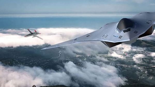
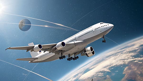
Military fighter jets cruising

Aviation Industry

Our products are integral to the aviation industry, providing high-precision navigation and stability solutions for aircraft systems. With advanced gyroscopes and inertial measurement units (IMUs), we ensure reliable performance in flight control, navigation, and guidance systems, enhancing safety and operational efficiency.

Military tanks in motion

Defense and Military Industry

Our products are critical in the defense and military industry, offering precise navigation, stabilization, and guidance solutions for various military applications. From missile guidance systems to unmanned vehicles, our high-precision gyroscopes and inertial navigation systems ensure reliable performance in demanding and high-risk environments.

Tanker in transit

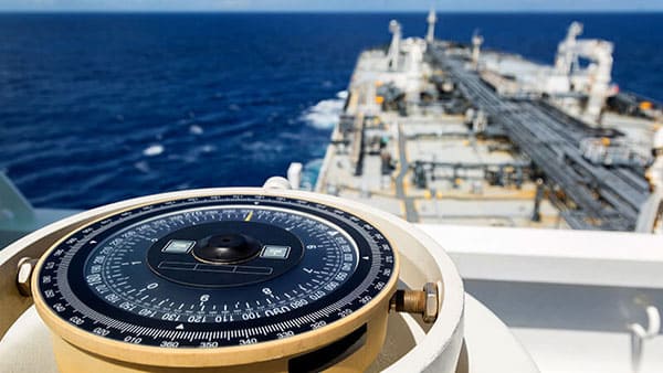
Maritime Navigation and Detection Industry

Our products are vital in the maritime navigation and detection industry, providing precise and reliable solutions for underwater and surface vessels. With advanced gyroscopes and inertial navigation systems, we support accurate positioning, navigation, and detection, ensuring safe and efficient operations in challenging marine environments.

High-speed train in motion

Rail Transit Industry

Our products are essential in the rail transit industry, providing reliable navigation and stability solutions for trains and other rail vehicles. With high-precision gyroscopes and inertial navigation systems, we ensure safe, efficient, and accurate operation of rail systems, supporting both on-board control and infrastructure management.

Space station capsule

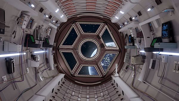
Space Exploration Industry

Our products are crucial in the space exploration industry, offering precise navigation and orientation solutions for spacecraft, rovers, and satellites. With advanced gyroscopes and inertial measurement units (IMUs), we ensure reliable performance in the extreme conditions of space, supporting accurate positioning and stability during missions to explore the universe.

Offshore drilling platform

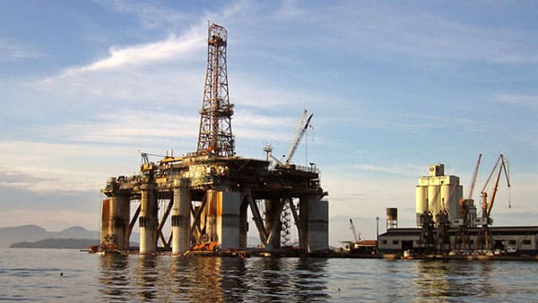
Geological Exploration Industry

Our products play a key role in the geological exploration industry, providing accurate and reliable navigation and measurement solutions for surveying equipment, drilling systems, and exploration vehicles. With high-precision gyroscopes and inertial navigation systems, we ensure precise positioning and stability, even in challenging and remote environments.

After-Sales Service

At GYRONAVI, we understand that reliability and precision are crucial in the field of inertial navigation systems. That’s why we not only provide cutting-edge products but also offer a robust after-sales support structure designed to keep your systems running smoothly, ensuring uninterrupted business operations. With our 7 days, 12 hours service and 3-year warranty, you are not just buying products — you’re securing a long-term partnership for continuous support and success.

Why Choose Our After-Sales Service?

  • 12-Hour Technical Issue Resolution: We guarantee to resolve your product’s technical issues within 12 hours.
  • 3-Year Warranty: All products come with a comprehensive 3-year warranty for peace of mind.
  • Expert Technical Support: Our team is ready to assist with any technical queries or issues regarding our products.
  • Global Service Network: We provide tailored support with fast response times, no matter where you’re located.
  • Spare Parts Availability: A well-stocked inventory ensures quick replacement of parts to minimize downtime.

FAQs

There are several types of IMUs, including low-cost MEMS-based IMUs, medium-grade IMUs for automotive and robotics, and high-performance IMUs used in aerospace and military applications.

While IMUs measure motion and orientation, GPS provides position data. IMUs are used for accurate short-term measurements when GPS signals are not available or reliable.

Magnetometers measure the magnetic field and are used to correct orientation data, helping IMUs maintain accurate heading or direction.

Sensor fusion is the process of combining data from multiple sensors, such as accelerometers, gyroscopes, and magnetometers, to improve the accuracy and reliability of IMU measurements.

Drift refers to the gradual accumulation of errors over time in the measurements provided by an IMU, especially for position and orientation data.

Yes, IMUs can be integrated with other sensors, such as barometers, magnetometers, and GPS units, to improve overall system performance.

A 2D IMU measures motion and orientation in two axes, while a 3D IMU measures in three axes, providing more comprehensive data.

IMU drift can be minimized by using sensor fusion techniques, periodic calibration, and combining data from other positioning systems such as GPS.

GYRONAVI’s IMUs are designed to resist electromagnetic interference through shielding techniques and optimized design, ensuring stable performance in noisy environments.

Yes, IMUs can provide long-term tracking, especially in GPS-denied environments. By combining data from other sensors, IMUs can maintain accurate position and orientation for extended periods.

Get Your Customized Motion Control Solutions Today

Choosing GYRONAVI’s Inertial Measurement Unit (IMU)  means selecting high precision, high stability, environmental adaptability, and cost-effectiveness. No matter how harsh your operating environment or how unique your requirements, we can offer tailored solutions that ensure the most accurate and reliable measurements. Additionally, we are committed to providing world-class technical support and after-sales service, ensuring the long-term stable operation of your products.By choosing GYRONAVI, you are not just selecting a supplier, but a comprehensive partner committed to providing continuous support and efficient solutions for your projects. Contact us now to experience our custom-designed, high-performance Inertial Measurement Unit (IMU) products and take your business to greater success!

Thank you for your trust

We will contact you via email within 12 hours.